

Unmapped vs Mapped Exercise Areas
Unmapped
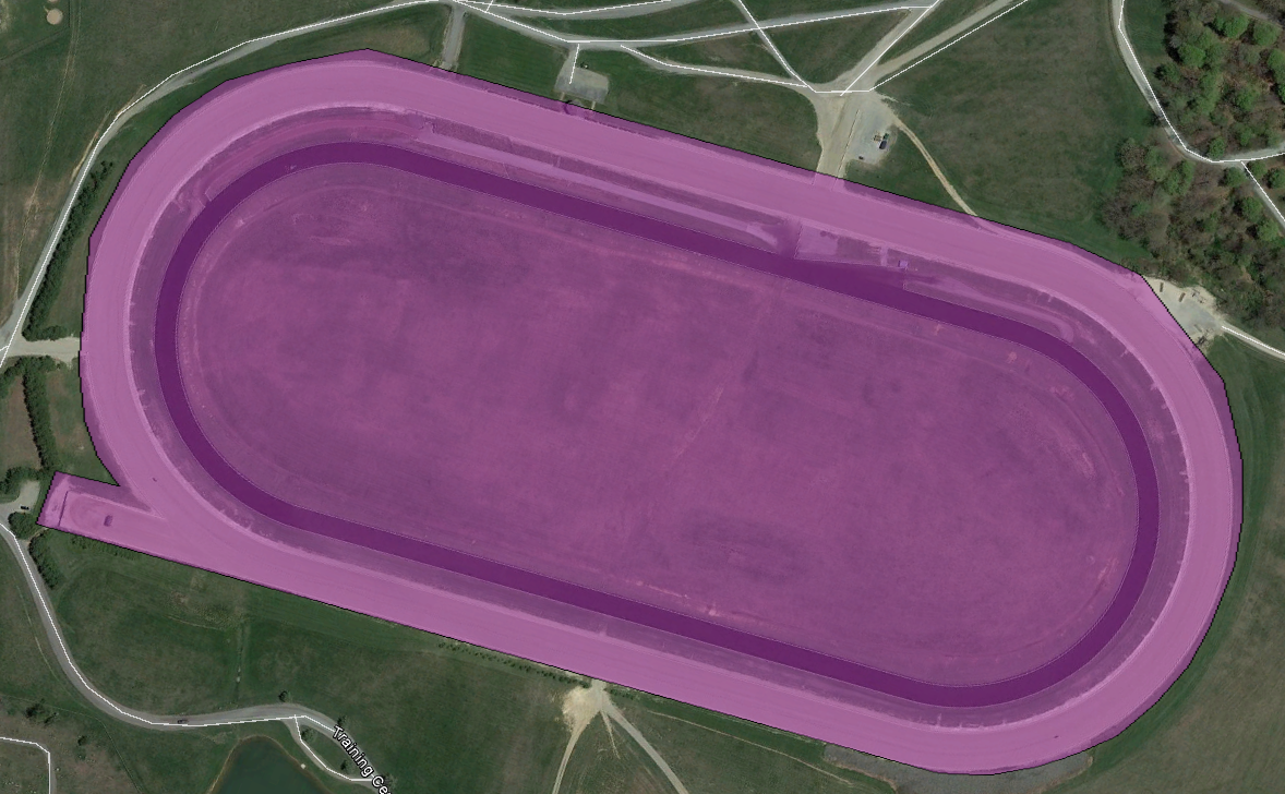
When you first get up and running with equinITy, you will be using an unmapped exercise area. Using a process of geo-fencing, we "draw" around your facility. When you are inside this area (marked in purple below) and moving at a determined speed (which can be modified at your request), you are exercising and this is what is rendered in the post-work analysis. During Live Streaming, you will see speed, heart rate and stride data in real time.
Mapped
In order to add real-time splits/sectionals to the live streaming, you need to have a Mapped exercise area. This process involves building a detailed model of the facility in order to pin-point the locations of the markers (200m, furlongs etc.) to form intersection lines (yellow). Using this model, the system can detect the horse passing each marker and use this to accurately determine splits/sectionals which correspond to the physical markers at the facility.

What's Needed?
Clearly, to create such a model, an accurate measurement of the pole/marker locations. You can measure these locations (GPS co-ordinates) with any GPS-enabled device but the recommendation is to use your equinITy Monitoring Device as follows:
Start up your device as normal, ensuring a GPS lock is acquired (GSM connection not necessary)
Walk the track/gallop along the inside rail/edge in the standard direction of travel
At each marker location, walk back and forth between the inside and out three times - this creates a cluster of GPS points which can determine the marker when viewed
Walk to the remaining poles and repeat
Plug in your device to upload the data
Contact support (email support@equinitytechnology.com) once you've uploaded your collected data points and we will produce a mock-up for your approval before the actual modelling exercise is carried out